The Creators Project • Artist Duo Project Videos on the Banks of the LA River
Category : UnderLA

Source: Artist Duo Project Videos on the Banks of the LA River,  Andrew Nunes. VICE: The Creators Project, August 8, 2016

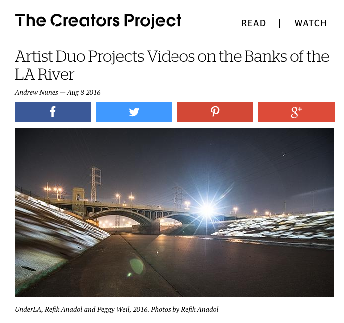
You’ll find more than an abundance of questionable, murky water in the LA River this summer: Artists Peggy Weil and Refik Anadol have joined forces to project a series of videos and animations along the 48-mile river until August 14th. Titled UnderLA, the video installation is a commission for CURRENT: LA Water, a public art biennial currently celebrating its inaugural year. With the whole city as a potential exhibition space, the project ended up in two specific locations: the First Street Bridge and at the origin of the LA River in Canoga Park. The five video sequences projected onto the river depict the inner geological workings of Los Angeles, showing the lithological soil and sediment that lie beneath the metropolis. The videos show a wide range of earthly depth, starting at 10 feet and reaching as far down as 1,400 feet beneath the soil, highlighting over 2 million years of geological development. The work is a meta-unraveling of what makes up Los Angeles; uncovering that which is underneath the city but rarely seen or discussed, displayed on the familiar surface its citizens interact with everyday.

Both of the artists came to the project from distinct backgrounds. Weil had previously worked on a project that visualized the data of global groundwater on signboards in Times Square while Anadol has worked with public architectural installations for the past 7 years, and created an incredible projection mapping show inside the Walt Disney Concert Hall. As two LA residents working in large-scale installations, the LA Public Art Biennial revealed itself as an incredible opportunity to join their two crafts and create a meaningful artistic exploration into the science of their own city. “We inhabit such a small slice of space on land, and yet our lives and society are profoundly affected by our geology,” Weil tells The Creators Project.

The raw and (literally) underground footage of the project was not straightforward to acquire. After all, digging nearly half a kilometer into city soil is neither practical nor legal under most circumstances. Luckily for Weil and Anadol, the United States Geological Survey provided a helping hand: “I assumed there would be a comprehensive CG 3D model of the LA Basin and I reached out to Michael Land, a USGS hydrologist who began a series of conversations about how the USGS maps and monitors the basin,” Weil explains. “The minute I saw a photo of one of the boxes of soil samples I could see the entire sequence. I was struck by the beauty and variance of the samples and the stories they held. So while these images of layers of rock and silt and sand and clay don’t look like water, this is what water looks like under Los Angeles. It’s our history and it’s our future.”

Armed with footage rarely seen by surface-dwellers and with the city as their canvas, the duo set out to educate their potential audience: “One of the most critical parts of the project was it’s massive potential to create new forms of outreach for Los Angeles. I’ve been a part of many public performances around the world, but I’m always wondering why Los Angeles is lacking public interventions,” adds Anadol. “If we can bring any level of attention and awareness to the importance of water, I highly believe we’ve succeeded. And so far, the audience seems to be heading towards that direction.”
The Atlantic CityLAB • A 1,400-Foot Journey Through L.A.’s Groundwater Supply

Category : UnderLA

Source: A 1,400-Foot Journey Through L.A.’s Groundwater Supply, The Atlantic CityLAB, Eillie Anzilotti, August 4, 2016

California is drying up. The drought that’s plagued the state for the past five years shows no sign of relenting, and it’s taking a toll on the landscape of Los Angeles: lawns sit brown and thirsty, the Los Angeles River flows sluggishly.

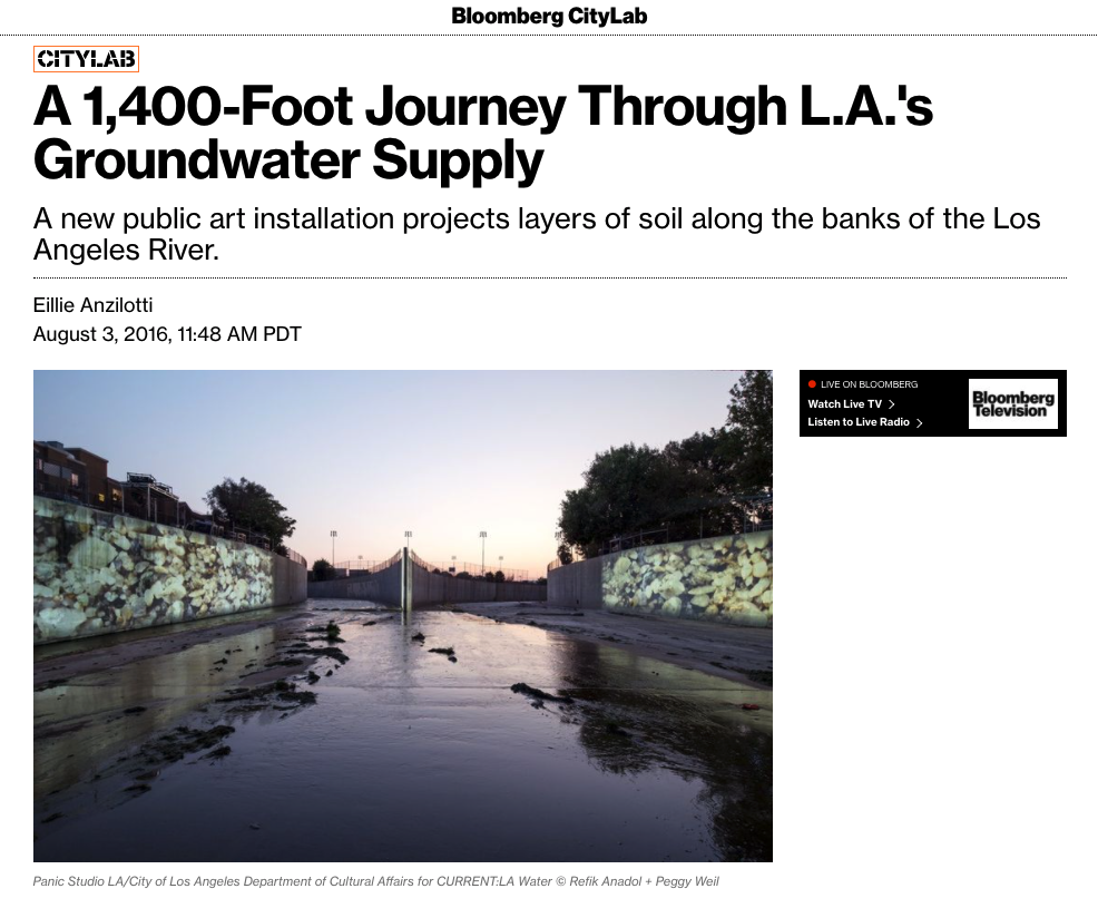
A new art installation, UnderLA, adds another dimension to the reach of the drought. At two sites along the concrete banks of the L.A. River—the First Street Bridge and the river’s origin at the intersection of Arroyo Calabasas and Bell Creek—the artists Peggy Weil and Refik Anadol have projected a slow-moving journey 1,400 feet below the surface of the city. Scrolling through images of soil samples taken at intervals of 10 feet, the projections—commissioned by the City of Los Angeles as part of L.A.’s first public art biennial, Current:LA Water—detail the increasingly stressed and vulnerable aquifer system underpinning the city.

In a sense, Weil says, the installation is “a straightforward photographic landscape of these incremental soil samples.” The artists worked with researchers from the U.S. Geological survey to photograph soil samples taken from two Los Angeles wells, both located close to the projection sites; interspersed throughout the scrolling videos (below) are USGS data testifying to fluctuating water levels at those same well sites.

But watching the video play across the wide swaths of riverbank is a transformative experience. “As you descend in space, you’re also going back in time—at 1,400 feet, you’ve gone back 2.5 million years,” Weil says. In each aquifer layer, “there are recognizable fragments: shells, little bits of wood, colored rocks—things you’d see on the surface layer,” she adds. “But it’s incredibly moving to realize that they’ve been underground for that long, and that they’re forming a foundation we still depend on.”

more


Fast Company • The L.A. River Is Now A Temporary Art Museum

Category : UnderLA

FastCo UnderLA

Source: The L.A. River Is Now A Temporary Art Museum, Fast Company Exist, Adele Peters, July 26th, 2016

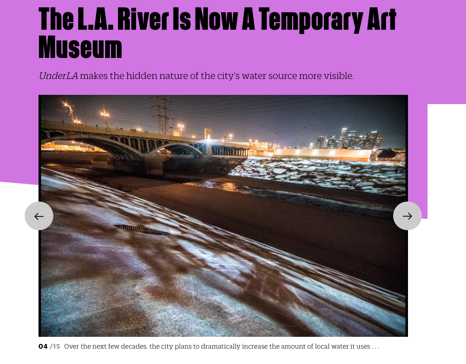
Ask someone in Los Angeles where the city’s water comes from, and they might mention the Colorado River or the massive aqueduct that brings water hundreds of miles from the north. But some of the city’s water is also local. A new work of art called UnderLA, projected on the concrete sides of the L.A. River, shows the water hidden underground.

“We used the L.A. River as a canvas, and light as a material, and we project several visual stories,” says artist Refik Anadol, who collaborated with Peggy Weil on the project. It’s 1 of 16 installations up now around the city—on and around the river—as part of Current:LA Water, a new public art biennial.

Some of the projections in UnderLA show layers of sediment in local wells. “As you go down in depth, you’re also going back in time,” says Weil. “I think by 1,000 feet you’ve gone back a million years. There’s an emotional component to this, because it’s our history, and it’s also our future.” Another part of the visualization shows how water levels have risen and fallen with drought and overuse.

Over the next few decades, the city plans to dramatically increase the amount of local water it uses—partly by redesigning infrastructure so the little rainfall L.A. gets goes back into the ground, instead of draining down streets to the ocean. The artists wanted to make data about that groundwater accessible and interesting. “We tried to visualize this data by poetic connection,” says Anadol.


KCET Artbound • A Guide to CURRENT:LA Water

Category : UnderLA

Screen Shot 2016-07-21 at 3.45.02 PM

Source: A Guide to CURRENT:LA Water   KCET Artbound, Carren Jao, July 16, 2016

“UnderLA” by Refik Anadol and Peggy Weil at 1st Street Bridge, between Santa Fe Avenue and Mission Road, downtown Los Angeles, and at the mouth of the L.A. River, 6883 Owensmouth Avenue, Canoga Park.

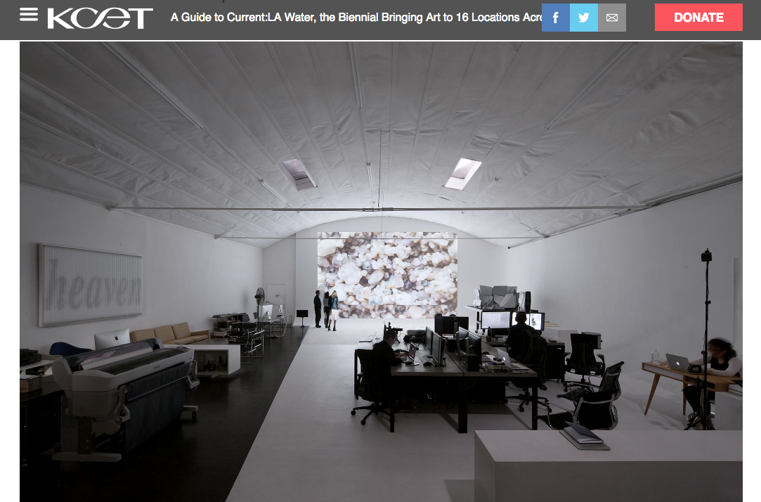
Though it doesn’t flow, groundwater is very much a part of the city’s water system. Artist Peggy Weil and Refik Anadol finally let Angelenos see deep into the earth by projecting arresting images of porous rock capable of holding and transmitting water — L.A.’s aquifers — onto the concrete banks of the Los Angeles River.

The artist team worked with USGS geologists to obtain data and images of ground slices below an Angeleno’s feet up to 1,400 feet below the ground. The projection is a visual walk through time, says Weil. At 1,400 feet, the ground holds marks of events that can be traces as far back as 2.5 million years ago. The images are interspersed with data visualization that shows the rise and fall of water levels at different points in time. Its apices and nadirs are a reminder of Los Angeles’ continual struggle for hydration.


@